FIRST ALERT: Showers early, Arctic air crashes in quickly
A powerful cold front will allow temperatures to quickly fall throughout the day.
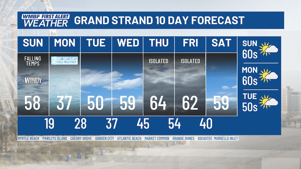
MYRTLE BEACH, SC (WMBF) - Dangerously cold Arctic Air arrives in the Carolinas Sunday evening through Monday.
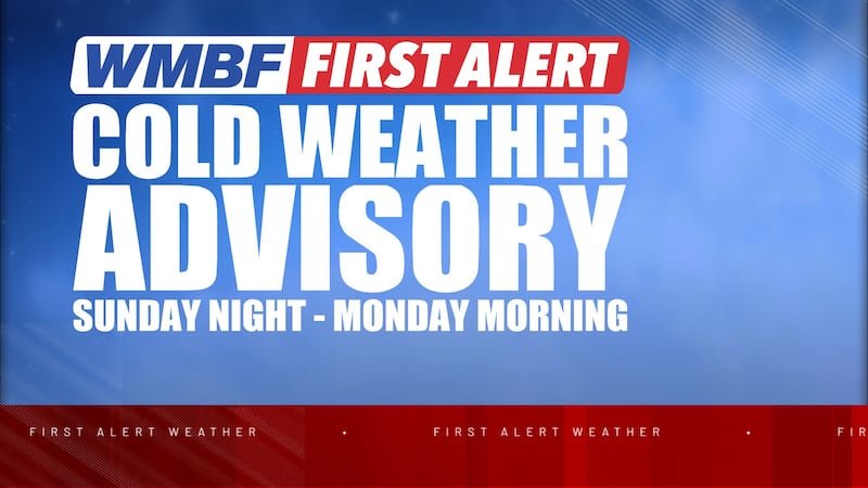
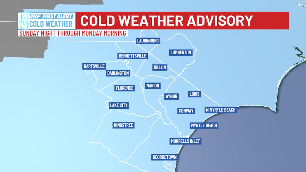
A COLD WEATHER ADVISORY has been issued for all of the Grand Strand and Pee from late tonight through Monday morning as wind chills are likely to drop as low as 5 to 10 degrees.
The cold wind chills as low as 5 to 10 above zero could result in hypothermia or frostbite if precautions are not taken.
Dress in layers including a hat, face mask, and gloves if you must go outside. To prevent water pipes from freezing; wrap or drain or allow them to drip slowly. Make frequent checks on older family, friends, and neighbors. Ensure portable heaters are used correctly. Do not use generators or grills inside.
ARCTIC BLAST ARRIVES TODAY INTO MONDAY
A powerful cold front will move through today, bringing both rain chances this morning and the start of the arctic air moving into the area.
While we don’t expect rain all day, we do expect to see a couple of downpours and showers this morning. We’ll keep the rain chances scattered and light through the morning hours as the powerful cold front slides through the area.
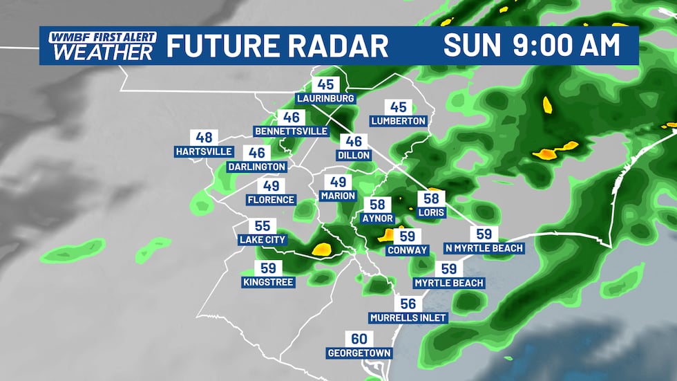
As the front passes through, rain chances and clouds will quickly clear out for the rest of the day. Unfortunately, that’s when the wind and the cold are set to arrive. Temperatures will tumble fast throughout the day.
Our high temperature will happen this morning before the rain. Inland areas are in the upper 50s before the rain begins with the lower 60s for the beaches. Behind the front today, those temperatures tumble and the wind chills become relevant quick.
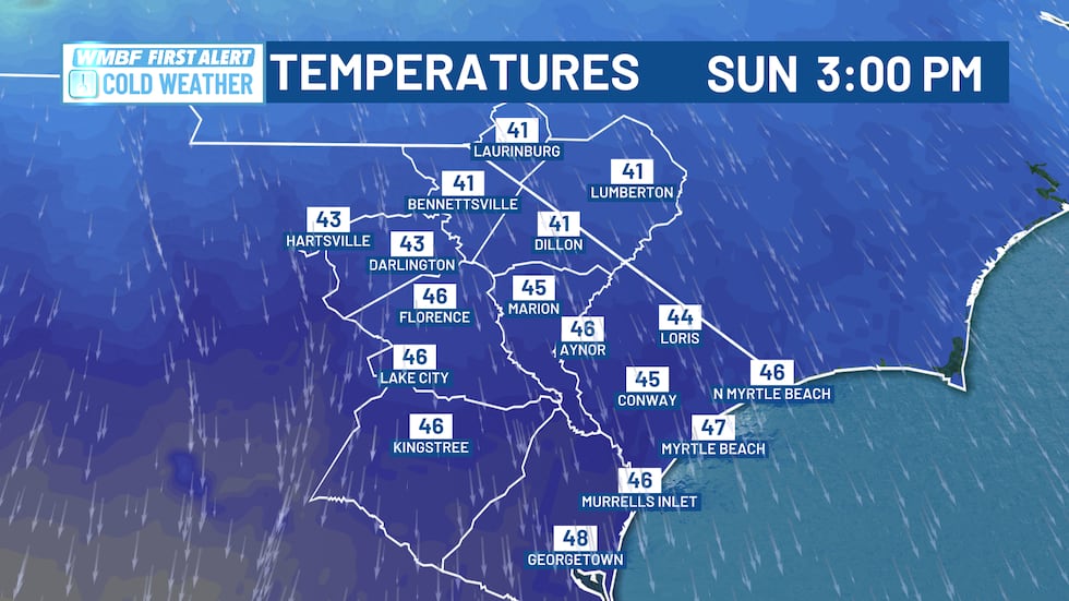
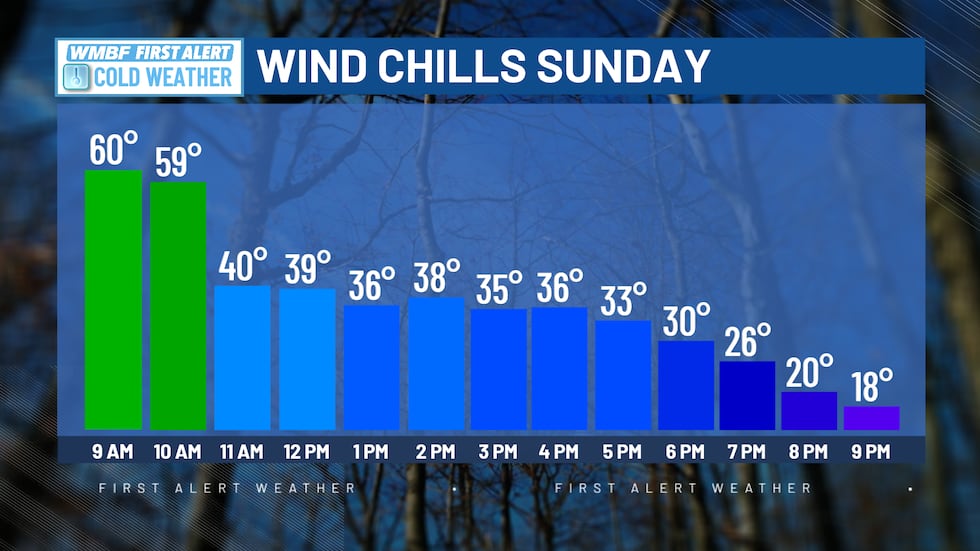
Temperatures this afternoon will fall into the low-mid 40s. If you have any plans this afternoon or even this evening, bundle up! Factor in the wind chills and the temperatures will feel like the 20s and 30s this afternoon and into the early evening hours.
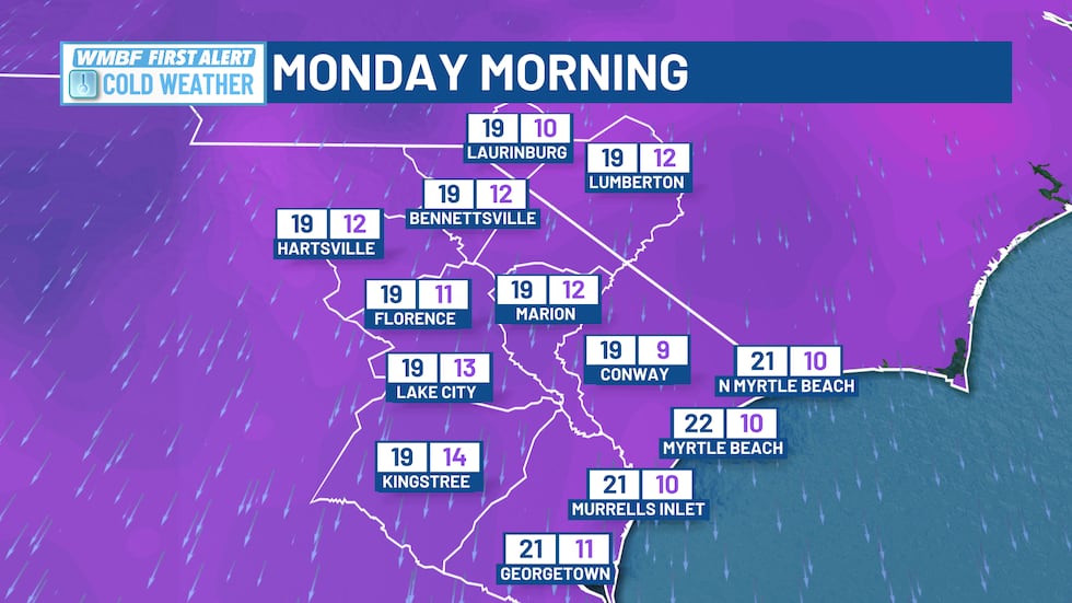
Temperatures will quickly fall overnight tonight, leading to the coldest air so far this season. Temperatures will fall into the teens for both the Grand Strand and Pee Dee as you are waking up Monday morning. With the colder temperatures we are also going to factor in a wind which will make the feels like temperatures in the single digits for the beaches and inland areas. It is going to be brutally cold out on Monday morning. Give yourself extra time to get out of the house and dress accordingly.
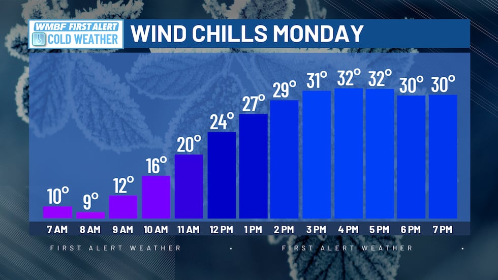
Temperatures on Monday are able to warm up to the mid to upper 30s with plenty of sunshine. The wind will continue, making it feel even colder throughout the entire day. Stay inside or if you have to do anything outdoors, make sure you are able to stay warm.
NEXT WEEK
The good news, the cold is not going to last long at all, as we head into the middle of the week temperatures are going to climb to the mid to upper 60s. Clouds will increase with a few showers LATE Thursday and into the overnight hours. A few lingering showers remain possible Friday morning with temperatures still in the 50s and 60s for the end of next week.
Feel more informed, prepared, and connected with WMBF. For more free content like this, download our apps. Have feedback that can help us improve? Click here.
Copyright 2025 WMBF. All rights reserved.